Great Barrier Reef catchments · Multispectral drone mapping

Paddock-scale evidence for the 2032 Reef targets.

We fly multispectral surveys over cane, horticulture and grazing country from the Wet Tropics to the Burnett Mary, and turn them into two things: maps agronomists can act on, and before-and-after evidence that NRM programs can report against.

The new targets, reef-wide

1,677 t
dissolved inorganic nitrogen
1,510 kt
fine sediment
2,617 t
particulate nitrogen
1,263 t
particulate phosphorus

End-of-catchment load reductions against a 2023 baseline, to be achieved by 2032. Reef 2050 Catchment Water Quality Strategy, May 2026.

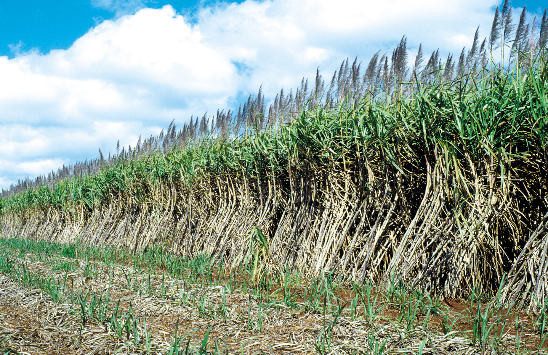
Young and mature sugarcane crops at Atherton, Queensland
Young and mature sugarcane, Atherton, Queensland. Photo: Willem van Aken / CSIRO, CC BY 3.0, via Wikimedia Commons. Cropped for display.

What's changed

The program landscape has moved. Here's what it asks for now.

If your last reef project was written against the Water Quality Improvement Plan, the ground has shifted. Four changes matter most for anyone planning work in 2027.

A new strategy, new targets

The Reef 2050 Catchment Water Quality Strategy, released in May 2026, replaces the Water Quality Improvement Plan. It sets end-of-catchment targets for each of the 35 Reef catchments against a 2023 baseline, due by 2032, alongside indicators for waterway health, landscape resilience and community stewardship.

Investment follows priority

The Spatial Management Prioritisation framework and the catchment profiles steer funding to the sub-catchments and land uses that matter most to the Reef. Projects need to show they are working in the right place, and that the work is changing something.

Reefwise Farming: $30M to 2027–28

Reef Trust is funding four NRM-led projects: irrigation efficiency in the Lower Burdekin, agronomy and chemical management in Mackay Whitsunday, precision agriculture and riparian restoration in the Burnett Mary, and fertiliser, disease and pest management in the Wet Tropics.

Evidence is worth more

The regulated standards for cane, bananas and grazing were reviewed in 2025, and the Queensland Government is weighing the recommendations. Reef Credits pay for verified reductions: one credit per kilogram of DIN, or per 538 kg of fine sediment. Either way, documented practice change carries real weight.

Progress toward the 2025 targets: nitrogen is the gap.

Met particulate P 87.8% particulate N 71.2% fine sediment 53.5% dissolved inorganic N

What we measure

What multispectral shows, and the objective it serves.

A multispectral sensor records the green, red, red-edge and near-infrared light a canopy reflects. Plants under nutrient, water or disease stress reflect differently, often before the eye can see it. Flown at centimetre resolution and calibrated, that becomes something you can measure, compare and act on.

MeasureWhat it showsObjective it serves

Crop vigour and nitrogen response

Variation in canopy vigour and chlorophyll between and within blocks, from red-edge and near-infrared reflectance.

Nitrogen matched to yield potential. Zone maps for variable-rate application. Lower DIN loss.

Irrigation uniformity and waterlogging

Stress patterns that follow furrow length, set times, pump performance and poorly draining ground.

Irrigation efficiency. Less nitrogen and pesticide lost to runoff and groundwater.

Ground cover and land condition

Green and dry cover, bare scalds and patch grazing across whole paddocks and properties at the end of the dry season.

The 70% late-dry-season cover benchmark. Less hillslope erosion and fine sediment.

Gully and streambank works

Baseline extent, as-built condition and vegetation establishment on treated sites, paired with photogrammetric surface models to measure volume change over time.

Fine sediment, particulate N and P. Monitoring and reporting on remediation investment.

Riparian and wetland vegetation

Canopy extent and condition along restored reaches, planting survival, and weed incursion.

Riparian and wetland indicators. Evidence for restoration, including Traditional Owner-led works.

Pest, disease and weed hotspots

Stress signatures that don't match nutrition or water patterns, flagged for checking on the ground.

Targeted rather than blanket chemical use. Lower pesticide loads.

Repeatable evidence

Calibrated, georeferenced reflectance over the same footprint, season after season, so change can be compared like for like.

Practice-change verification, project reporting, and supporting records for Reef Credit projects.

By region

Four regions, four different problems.

The 2032 targets are set catchment by catchment, and the pressures are not the same everywhere. Here is where each region sits and where drone multispectral fits.

Share of reef-wide DIN target Share of reef-wide fine sediment target

Wet Tropics · Terrain NRM

Nitrogen country.

1,029 t DIN
61%
138 kt sed.
9%

Six in every ten tonnes of the reef-wide DIN target sit here, led by the Johnstone (328 t), Tully (276 t) and Herbert (261 t). Terrain NRM's Reefwise Farming project ($7.5M) is helping cane growers fine-tune fertiliser and manage disease and pests.

Where we help

  • In-season vigour maps to set nitrogen rates block by block
  • Disease and pest hotspots flagged early for checking
  • Inter-row cover in cane and bananas
  • Drones fly under the wet-season cloud that blinds satellites

Burdekin Dry Tropics · NQ Dry Tropics

Sediment country, with irrigated cane at the bottom.

403 t DIN
24%
842 kt sed.
56%

The Burdekin catchment alone carries 800 kt of the reef-wide fine sediment target, more than half of it, mostly from gullies, streambanks and hillslopes in grazing country. Down on the delta, the Burdekin (238 t) and Haughton (154 t) carry most of the region's DIN. NQ Dry Tropics is delivering Burdekin Landscape Repair for gullies and streambanks, plus a $7.49M Reefwise Farming project on irrigation efficiency in Lower Burdekin cane.

Where we help

  • Fixed-wing ground cover surveys across whole grazing properties
  • Gully and streambank baselines, then repeat surveys on the same footprint
  • Irrigation uniformity mapping in Lower Burdekin cane

Mackay Whitsunday Isaac · Reef Catchments

Close to the Reef, little room for error.

96 t DIN
6%
127 kt sed.
8%

Short catchments mean what leaves a paddock reaches the lagoon quickly. The O'Connell carries 100 kt of fine sediment and 319 t of particulate nitrogen. Reef Catchments' Reefwise Farming project ($7.45M, to 2028) gives 60 cane growers agronomy support on nutrient and chemical management, and its Catchment Treatment Systems project is building on-farm water treatment.

Where we help

  • Vigour and zone maps the project agronomists can work from
  • Before-and-after monitoring of treatment systems and sediment basins
  • Streambank and grazing land condition in the O'Connell

Burnett Mary · Burnett Mary Regional Group

Precision agriculture and the riverbanks.

117 t DIN
7%
80 kt sed.
5%

The Burnett (64 t) and Mary (41 t) carry most of the region's DIN, and the Mary 67 kt of its fine sediment, much of it from streambank erosion. BMRG's Reefwise Farming project ($7.48M) is building precision agriculture skills on farms, with Traditional Owners leading riparian restoration. Its regional strategy aims to stop 18,000 tonnes of fine sediment a year reaching the Reef by 2030.

Where we help

  • Zone maps for cane and tree-crop growers starting precision agriculture
  • Planting survival and canopy monitoring on riparian restoration sites
  • Streambank site baselines and repeat surveys

Working in the Fitzroy or Cape York? Talk to us about your catchment.

For NRM bodies and delivery partners

Data your GIS team can use, and change your reports can show.

  • Calibrated reflectance GeoTIFFs, index layers and zone shapefiles, in GDA2020 / MGA.
  • Baseline-and-repeat surveys on the same footprint, so your monitoring and reporting shows change, not snapshots.
  • Scoped to your priority sub-catchments, project boundaries and reporting timelines.
  • Available per project, as a sub-contractor, or on a supplier panel.

For growers and graziers

The map that cuts nitrogen loss also finds the block that's underperforming.

  • Zone maps you can load into a rate controller or hand straight to your agronomist.
  • A clear record of what you've changed, for your nutrient management planning and program reporting.
  • Many reef-funded projects support agronomy and precision agriculture. Ask your NRM extension officer whether mapping fits your project, or ask us and we'll help you check.

Straight talk

What a drone doesn't replace.

Multispectral has been oversold before. We'd rather you knew where it fits.

Soil and leaf tests

Imagery shows where a crop is struggling. Samples tell you why. We point your sampling at the right spots.

Water quality monitoring and modelling

End-of-catchment loads come from sampling and Paddock to Reef modelling. We supply paddock-level evidence of practice and condition, not load estimates.

Satellite monitoring

Satellites remain the right tool for whole-catchment cover every year. Drones add the paddock-level detail, flexible capture timing and field-scale observations to complement satellite monitoring.

How a project runs

From program objective to a file you can open.

  1. 01

    Scope

    We start from your program objectives, priority areas and reporting dates, then plan flights around crop stage or end of dry season.

  2. 02

    Fly

    Calibrated multispectral capture: fixed wing for large areas, multi-rotor for close detail. Surveyed ground control points available where the work needs survey-grade accuracy.

  3. 03

    Interpret

    Reflectance, indices and management zones, read with agronomic context. You get findings, not just coloured maps.

  4. 04

    Deliver and repeat

    GIS files plus a plain-English report. Next season we fly the same footprint, so the change is measurable.

Available now

Fixed-wing multispectral

Large areas in a single flight. Built for cane districts, horticulture blocks and whole grazing properties.

Available now

Multi-rotor multispectral

Close, detailed work on gullies, streambanks, riparian sites and trial strips, flown through our national pilot network.

Who we are

Built by someone who's sat on your side of the table.

Aspex founder Kimberly Olsen worked as a Senior Project Officer in Sustainable Agriculture at NQ Dry Tropics, on the Reef program. That means knowing what a project officer has to report, what a grower needs to see before changing a practice, and how far apart those two things can be.

Aspex exists to close that gap with data both sides trust, backed by a national network of drone pilots for coverage across the Reef regions.

Aspex is an independent contractor. We don't represent NQ Dry Tropics, any other NRM body, or the Reef program. We bring relevant experience from having worked inside them.

Planning reef work for the 2027 season?

Tell us the catchment, the land use and what you need to report. We'll tell you straight whether multispectral will help, and what it would cost.