
Orchards & horticulture
Identify weaker tree or crop zones, compare irrigation response and focus scouting in high-value production where individual rows or plants matter.
Multispectral Agriculture Intelligence
Aspex uses large-area multispectral capture to reveal patterns in crop vigour, pasture performance, vineyard variability and emerging stress — helping growers and agronomists decide where to look, sample and intervene.
The production problem
By the time poor growth, irrigation problems or crop stress are obvious at ground level, production has often already been affected.
Multispectral imagery does not replace the agronomist. It gives the agronomist and producer a much better place to start — highlighting where crop or pasture response differs so attention can be directed to the areas most likely to need investigation.
The value is not an NDVI map. It is knowing where to look, what to compare and where not to waste time or inputs.
Where Aspex removes production uncertainty
The crop changes. The commercial question is similar: where is performance different, why might that be happening, and where should the next field decision be focused?

Broadacre cropping
Large broadacre fields can hide significant variability in establishment, vigour, moisture response and crop condition.
Multispectral capture can help identify areas of unusually weak or strong crop response, support targeted scouting, compare management zones and provide evidence for variable-rate or site-specific decisions where the agronomist and farm system support them.
It can also help compare crop response after fertiliser, irrigation or treatment changes — giving the grower a repeatable way to see whether an intervention actually changed the field.
Dairy & intensive grazing
For dairy and grazing systems, pasture variability becomes a feed-budget and utilisation problem.
Repeat multispectral surveys can show relative pasture performance across paddocks, highlight areas responding poorly to irrigation or fertility, and support more focused ground assessment before the next grazing or renovation decision.
Where ground measurements are available, multispectral trends can also support biomass and feed-availability assessment rather than relying on visual estimation alone.
Viticulture
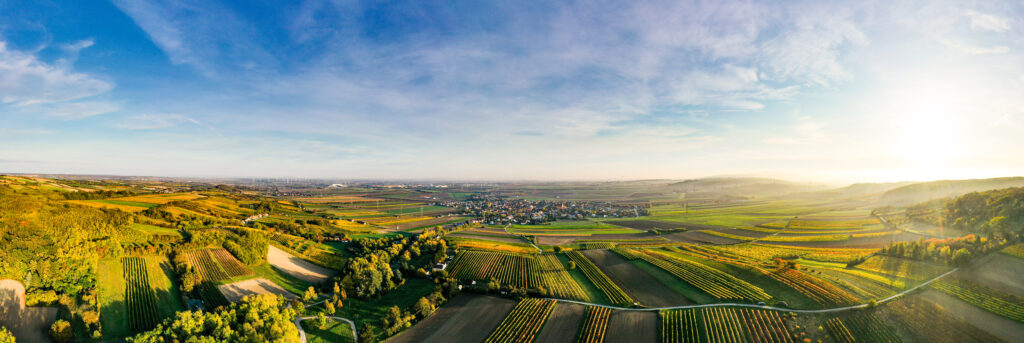
Vineyards often contain strong within-block variation that is difficult to appreciate from the ground.
Multispectral mapping can divide the vineyard into relative vigour zones, identify areas warranting closer inspection and support more targeted sampling, irrigation and canopy-management decisions. Repeated surveys can also show whether weak areas are stable, improving or deteriorating through the season.
For premium viticulture, that means less blanket inspection and a better evidence base for deciding where quality or yield risk deserves attention first.
The Aspex agriculture principle
Other high-value applications
Identify weaker tree or crop zones, compare irrigation response and focus scouting in high-value production where individual rows or plants matter.
Compare treatment response, growth variability and plot performance consistently across research or commercial trial areas.
Map the spatial extent of hail, frost, flooding, waterlogging or other events to support field inspection and recovery planning.
Create management zones that can support variable-rate fertiliser, irrigation or other inputs when combined with agronomic interpretation and compatible machinery.
Use unusual spectral response to identify areas deserving closer inspection. Multispectral imagery highlights patterns; field verification determines the cause.
Build a repeatable record of field performance so changes can be compared between seasons, varieties, treatments or management strategies.

Large-area multispectral capture
Aspex uses fixed-wing multispectral capability, including the Parrot Sequoia sensor, to cover large properties efficiently and capture reflectance data beyond normal RGB imagery.
Depending on crop, timing and objective, that data can be processed into vegetation-index and reflectance products that reveal relative differences in canopy condition, chlorophyll response and plant vigour.
We deliberately do not diagnose agronomic causes from imagery alone. The map identifies where conditions differ; your agronomist, soil tests, plant tissue tests and field inspection establish why.
What changes for the producer
Direct field scouting to places where crop or pasture response is materially different from the rest.
Support management zones rather than assuming the entire field needs the same response.
Repeat capture gives you a before-and-after view instead of relying on memory or isolated samples.
Fixed-wing coverage makes broadacre-scale monitoring practical where walking or ground inspection alone is too slow.
Start with the production question
Tell us the crop, property size, location, timing and the problem you are trying to investigate. We will recommend a practical capture and analysis approach.
Discuss an Agriculture Survey