

Aspex Drones- Solar & Wind Farm, UAV Inspections, Mapping and Ag

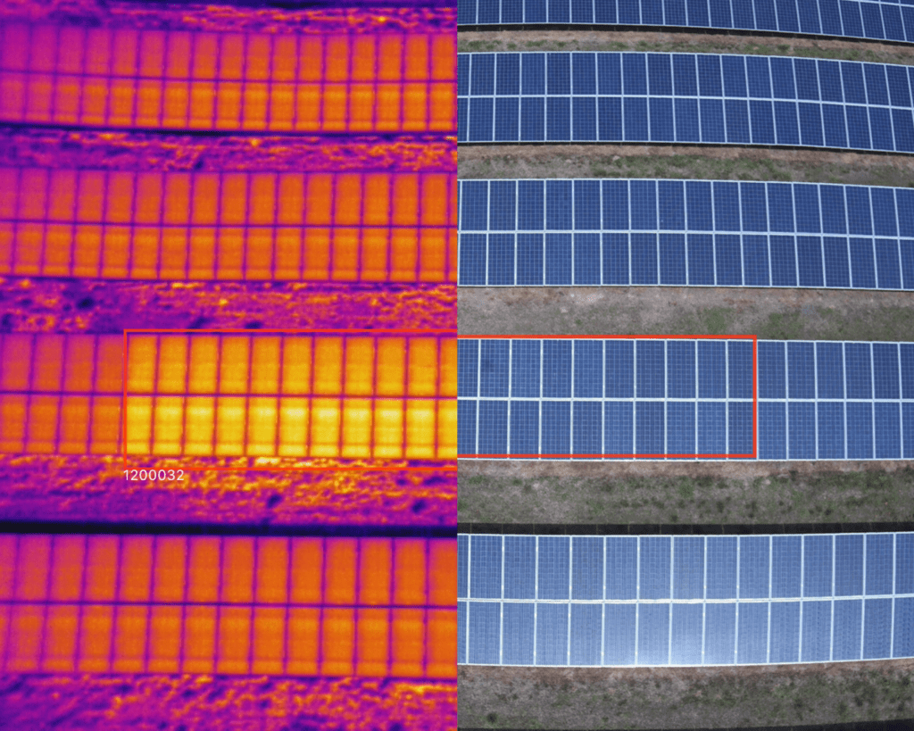
Solar Farm Thermography and Construction Monitoring

Smarter Maintenance. Fewer Surprises.

Unplanned maintenance can cost up to four times more than planned servicing — and it’s getting harder to stay ahead with shrinking teams and rising site complexity.

At Aspex Drone Services, we help Australian solar farm operators shift from reactive to proactive maintenance through AI-powered aerial thermography.
In partnership with Sitemark, we transform high-resolution drone data into actionable insights that cut downtime and boost energy yield. 

Fast, accurate, and data-driven.
From capture to analysis, we deliver complete inspection reports and digital twins within days — so you can act before performance drops.

Check out construction monitoring at Sitemark

Learn more…

Request a Quote

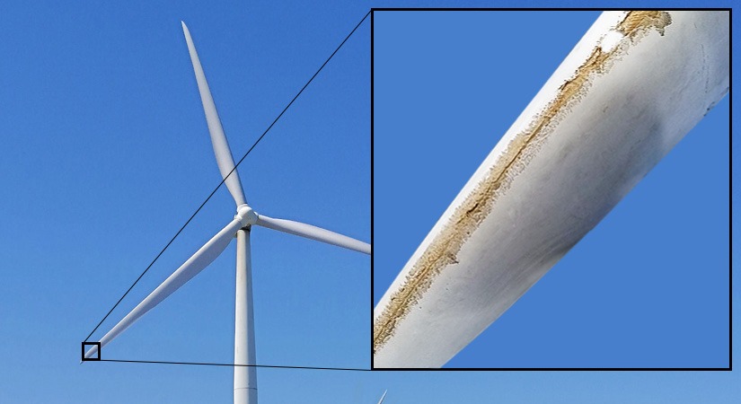
Wind Turbine Inspections

Data visibility is critical to overcoming reactive maintenance cycles in wind farm maintenance.
Reactive approaches to wind turbines lead to higher costs and reduced energy production.
Data analytics can transform how operations and maintenance teams tackle aging infrastructure in Australia’s wind energy sector.

At Aspex Drone Services, we provide advanced wind turbine inspections using high-resolution thermal and RGB imaging to ensure the efficiency and longevity of your wind energy assets. Through our partnership with Scopito, we deliver detailed aerial inspections that identify blade defects, structural issues, and thermal anomalies—helping you detect potential failures early and reduce costly downtime. Our drone-based solutions offer a fast, safe, and cost-effective alternative to traditional inspection methods, empowering wind farm operators with precise, data-driven insights for proactive maintenance and optimal performance.

Ask us about construction monitoring at Sitemark
Learn more…

Construction Site Monitoring Solutions with Cutting-Edge Digitisation

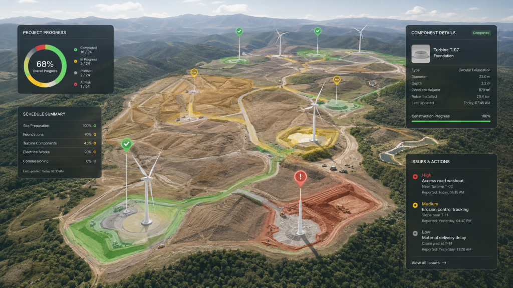
At Aspex Drone Services, we can take construction monitoring far beyond progress imagery. By partnering with Sitemark, we can help transform an active construction site into a living digital environment — combining drone data with component-level tracking, construction progress, asset information, issue management and stakeholder visibility. The result is a powerful, continuously updated view of the project that gives constructors, asset owners and project teams a far clearer understanding of what has been built, what’s next, and exactly where the project stands.

For asset owners and EPCs, construction monitoring should mean more than knowing what happened last week. By combining Aspex Drone Services’ aerial data capture with Sitemark’s digital construction platform, we can give project teams a clear, independent view of what has been built, what remains outstanding, where delays or issues are emerging, and whether reported progress reflects what is actually happening on site. The result is better visibility, stronger contractor accountability, faster decision-making and a digital record of the project from construction through to handover.

. See examples

Elevation modeling is also available today in order to see the layout of your latest construction project. Topographic models can also be generated for build sites that offer a challenging landscape. And volumetric measurements are now available to observe the usage of site fill, and more. where required, we deliver centimeter level accuracy using RTK/NTRIP.

Real Estate typically uses drones for images for sales which is important but, the high value work, that is useful to realtor, builder, sub-contractors, project managers and investors, comes from drone time-lapse and internal 360 during construction. Not only can you keep investors informed of progress in a professional and impressive way,  you can also record the locations of all services and other important assets that become invisible when the project is completed. See social media example

Infrastructure/Asset Inspections with AI Fully Autonomous Drones


Most drone inspections and 3D modelling flights still rely on semi-autonomous drones that require manual piloting skill to capture quality data and avoid asset damage. Aspex Drone Services removes this risk by using a fully autonomous, AI-driven UAV system capable of intelligent navigation and obstacle avoidance — even in complex or confined environments.

Our AI inspection platform captures ultra-high-resolution 3D models and digital twins at sub-millimetre (<1 mm) precision, delivering detailed, repeatable results that enhance decision-making and reduce downtime. We can safely inspect the most difficult assets — including towers, structures, tanks, bridges, and solar or wind components — without scaffolding or shutdowns.

Autonomous drone inspections are faster, safer, and more consistent than manual methods, requiring minimal setup and operator intervention. Data and visual outputs are automatically processed into 3D models, orthomosaics, and reports that can be shared instantly with engineers, asset managers, and stakeholders. Aspex proudly deploys the Skydio 2+ platform and 3D Automation workflows to deliver the next generation of infrastructure inspection.

Precision Survey-Grade Mapping with RTK Accuracy

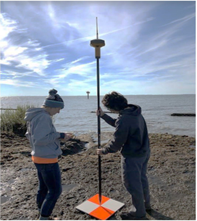
Aspex Drone Services delivers survey-grade aerial mapping and geospatial data acquisition with unmatched precision and efficiency. Using Real-Time Kinematic (RTK) positioning combined with Networked Transport of RTCM via Internet Protocol (NTRIP), our drone systems achieve centimeter-level accuracy—dramatically reducing reliance on ground control points and improving overall field productivity.

Our mixed fleet of rotorcraft and fixed-wing UAVs allows us to match aircraft to project scale and terrain. Fixed-wing drones efficiently survey up to 200 hectares per hour, ideal for large-scale mapping and linear infrastructure projects, while multirotor platforms excel in detailed site capture, construction monitoring, and terrain modeling.

For clients requiring certified survey deliverables, Aspex partners with licensed surveyors to ensure full compliance with regulatory and spatial data standards. From topographic mapping and volumetric analysis to infrastructure inspections and digital surface models, we provide high-resolution, geo-referenced data that supports accurate design, planning, and decision-making.

Precision Agricultural Mapping with RTK Accuracy

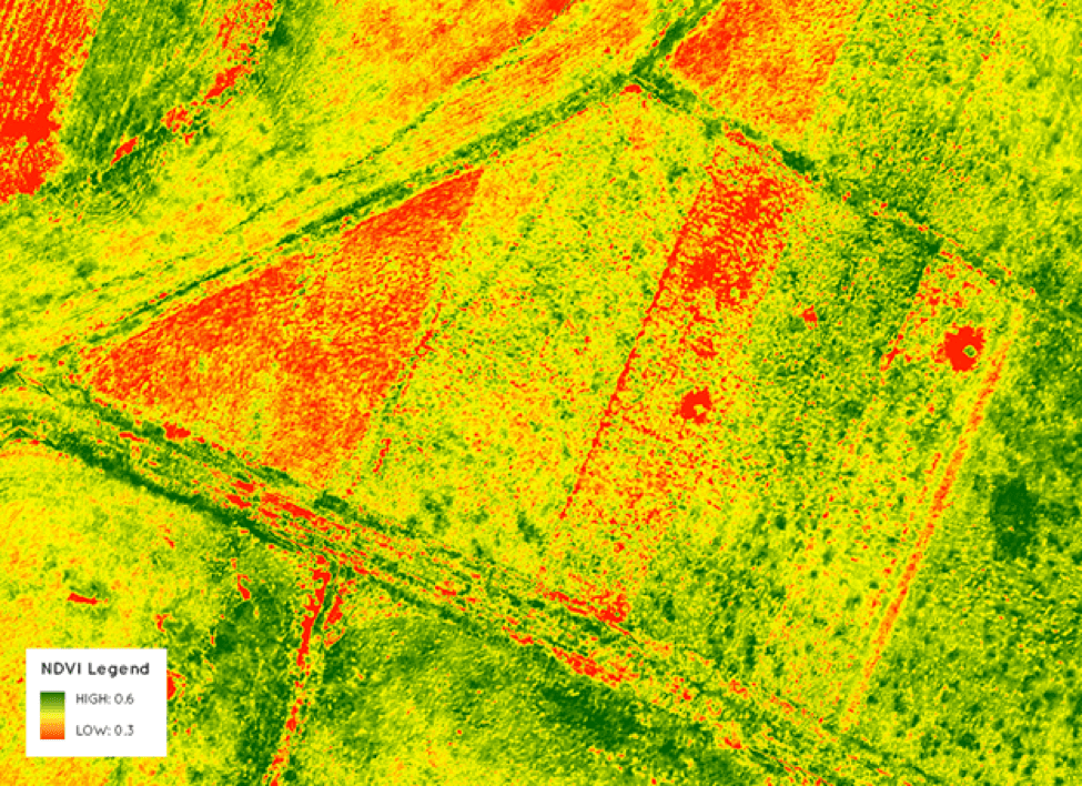
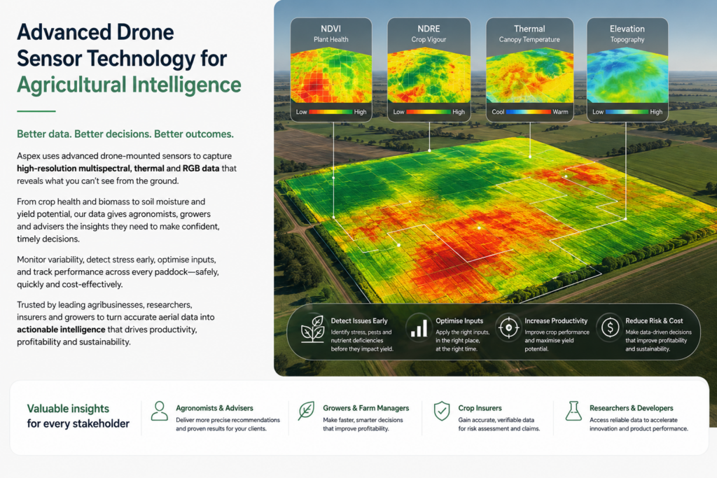
Aspex Drone Services delivers advanced precision agriculture mapping to help growers make informed, data-driven decisions. Using Real-Time Kinematic (RTK) positioning for centimeter-level accuracy, and multispectral imaging across visible, near-infrared (NIR), and red-edge bands, our UAV systems capture the fine details that define crop health and soil variability.

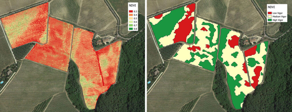
We generate high-resolution vegetation indices—including NDVI, GNDVI, and NDRE—to reveal patterns of plant vigor, stress, and nutrient distribution across every paddock. These insights support accurate field boundary mapping, weed identification, plant counting, and prescription map generation for variable-rate applications of fertilizers, herbicides, and irrigation.

By pinpointing specific areas of underperformance or nutrient deficiency, our drone data helps optimize resource use, reduce input costs, and increase yields while promoting sustainable farm management. Whether supporting broadacre cropping, horticulture, or regenerative agriculture, Aspex’s RTK-enabled multispectral mapping provides the accuracy and intelligence needed for modern farming.

Aerial Photography and Video

Aspex Drone Services provides professional aerial photography and videography that transforms how businesses showcase their properties and projects. In the real estate sector, drone imaging delivers unique aerial perspectives, immersive video tours, and panoramic views that help buyers experience a property from anywhere in the world. Our high-resolution aerial media supports marketing campaigns that stand out across social platforms and listings.

Today, aerial imaging extends far beyond property sales. Businesses use drone visuals to create compelling brand stories, capture large-scale facilities, or enhance digital advertising with a striking bird’s-eye view. Aerial footage adds immediate impact and professionalism to online marketing campaigns, brochures, and corporate presentations.

Whether you manage a resort, B&B, motor lodge, or commercial venue, drone photography and video can elevate your visual identity and attract more customers. Research shows travelers and consumers make decisions based on imagery quality and presentation—making aerial content a powerful driver for engagement, bookings, and brand trust.

Advanced Agricultural Intelligence from the Air

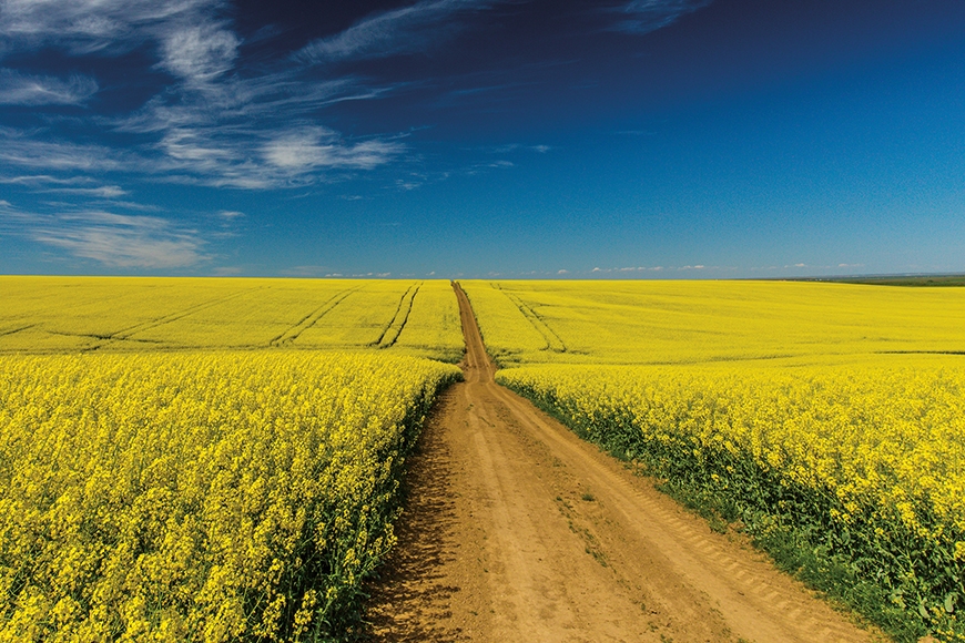
For growers, agronomists and agricultural advisors, better data means better decisions. Using advanced multispectral, thermal and RGB sensors, Aspex Drone Services can capture detailed crop information across entire paddocks quickly, safely and consistently — helping identify areas of stress, moisture variation, nutrient deficiency and uneven crop performance before they become obvious from the ground.

Instead of relying on broad averages or time-consuming manual inspections, our aerial data helps you focus attention where it is needed most. That can mean more targeted scouting, smarter input decisions, earlier intervention and a clearer understanding of how crops are responding throughout the season.

For agronomists, insurers, seed companies, researchers and agribusinesses, this creates a reliable, repeatable record of crop condition and variability over time. Combined with analytics and AI-assisted interpretation, Aspex turns complex aerial data into practical agricultural intelligence that supports productivity, reduces waste and helps improve confidence in every management decision.

Aspex Drone Services also supports regenerative agriculture assessment and monitoring by combining aerial crop intelligence with soil biological insights from Biome Makers. This allows growers, agronomists and land managers to look beyond what is happening above the ground and gain a deeper understanding of soil health, biological activity and how management practices are influencing the farming system over time. Used together, these technologies can help establish meaningful baselines, measure change, support regenerative management decisions and provide stronger evidence of outcomes across the property

Elevate Your Projects with Aspex’s Drone Aerial Inspections and
Agricultural Services

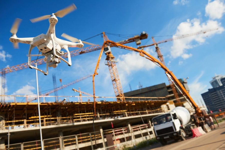
Aspex Drone Services delivers professional aerial inspections, mapping, and data solutions across Australia. In the construction sector, our RTK-enabled UAVs provide high-resolution site monitoring, helping project managers track progress, verify work quality, and keep stakeholders informed in real time.

Our AI-driven asset inspection drones operate safely indoors and outdoors, capturing imagery at sub-millimetre (<1 mm) resolution to create accurate 3D models and digital twins that integrate seamlessly with AutoCAD and BIM workflows.

In agriculture, our multispectral and thermal drone services deliver actionable insights on crop health, soil variation, and yield optimization, supporting precision and sustainability in farm management.


With years of field experience and a reputation for accuracy, Aspex is a trusted partner for construction, infrastructure, and agricultural industries seeking reliable, data-driven drone intelligence.

SE QLD, NSW, VIC
Sydney, Hunter Valley, Brisbane, Canberra, Wagga Wagga, Melbourne, Liverpool Plains, Gunnedah, Tamworth, Narrabri, Moree
Phone 0474910403

We’re presently experiencing issues with our VOIP so please call the mobile
 

1388 Bridgman Road, Mt Olive NSW 2330.

Phone 0474910403